Development Conflicts in the Caribbean

In response to a recent tweet from the CaribJournal that we relayed to some of our e-mail groups, we got the following tongue-in-cheek response to the linked press release extolling the completion of four units of the Zemi Beach (Anguilla) luxury residential project:

Anguilla’s @zemibeach Project Completes First Four Homes caribjournal.com/2013/07/29/ang… #anguilla

[In case you were wondering, this is a Zemi

 
The writer of this tirade describes himself as “a frightened Anguillian who has received threats”

“[The article] is also an example of the misuse of Twitter to promote lies and hype.”

The four units were completed last year.  The present announcement is non-news.

As I understand it, they sit there unsold because selling $3 million condos isn’t going so well on an island where Chief Minister Hubert Hughes loudly announces that war has been declared on the evil British and complete political independence is the only solution to what he calls oppression, slavery and genocide.

In November, the construction site was raided by the Immigration Task Force.  Many Spanish-speaking workers were taken away and all construction stopped for months. Both the developer and government have failed to respond to questions, except to predict various conflicting completion dates for the project.

The number of proposed units per acre rivals, in my opinion, slum dwellings.  Our Chief Minister defines a good project as one which has the most units per acre.

Our beloved leader’s memorable comments rival those of the developer:

<http://www.zemibeach.com/page/responsibilities>

“Developed with sustainability in mind. The backers of Zemi Beach are committed to following best practices in respect to the land and the people of Anguilla:

“The construction remains environmentally conscious, minimizing resources and avoiding heavy emissions and excess waste.”

Zemi Beach has stripped every leaf, every blade of grass, from their 6+ acres of land next to the Fountain National Park. As the land slopes down to the beach, this seems likely to create a river of mud the next time there’s a sustained, heavy rain, which will disperse out toward the reefs. Siltation kills reefs. Dead reefs don’t support fish.

What is Planning doing? What is the Dept. of Environment doing? What is Tourism doing?

Everything is concealed in secrecy.

***** ends *****

Here’s an example — this from the north coast of Tortola in 2010 —  of the kind of “river of mud” the frightened Anguillian refers to. . . .

sediment runoff2
Posted in Uncategorized | Leave a comment

Florida: The Future of Maryland’s Coastal Waters?

This article from the CARE-2 web site seems to describe a progression from dirty water to dead manatees . . . the description near the bottom of the article of the brown algae bloom on the Mosquito Lagoon in Florida seems very similar to increasingly opaque waters that I see outside on the banks of streams feeding the Chesapeake Bay, and which was documented with a photo by the Midshore Riverkeeper Conservancy on Facebook just today:

from: http://www.care2.com/causes/manatees-are-dying-with-suspicious-seaweed-in-their-mouths.html

Manatees Are Dying With Suspicious Seaweed in Their Mouths

Manatees Are Dying With Suspicious Seaweed in Their Mouths

Manatees have been categorized as endangered since 1973. Thanks to restrictions on motorboats in areas where they live and programs to rescue, treat and release them, their numbers have surged back, from 1,000 about 30 years ago to about 5,000 today. A couple of years ago, U.S. Fish and Wildlife Service officials even talked about changing the manatee’s status from endangered to threatened.

Budget constraints and other projects took precedence and such efforts were tabled. As it turns out, this has been for the better: in the past few years, manatees have been dying in alarming numbers. In 2010, 282 succumbed to unusually cold temperatures. Starting this past September, toxins from red tide — the recurring algae bloom that was worse than usual in southwest Florida, covering 130,000 acres — took the lives of 272 manatees.

In addition, restrictions on motorboats do not mean that manatees are entirely safe. About 80 to 100 die every year after being hit by boats.

About 100 Manatees Have Died Every Month of This Year

With 2013 about half over, around 600 manatees have died so far. In contrast, only 392 manatee deaths were recorded in 2012.

A federal researcher has pinpointed a toxic algae bloom in the Indian River lagoon as connected to the deaths of some 151 manatees, as well as to those of 51 dolphins and 300 pelicans. The algae blooms kill the seagrass which is a mainstay of the manatees’ diet. The manatees then end up eating seaweed, which proves deadly as toxins are affixed to it.

Indeed, some dead manatees have been found with food still in their mouths and digestive tracts. Researchers have discovered that they have been eating macroalgae, a kind of seaweed. While it is not usually toxic for manatees, scientists suspect something in the sediment in the lagoon, or even from the algae itself, could be rendering it lethal for them.

The dolphins and pelicans seem to be starving to death: as Megan Stolen, a biologist with Hubbs-Sea World Research Institute, says, 85 percent of the bodies of dolphins that she and her team have found are “skin and bones.” Scientists are speculating that their fish stocks could be depleted, or that they have been sickened by parasites, toxins or disease.

In another twist to the mysterious deaths of the manatees and dolphins, some other animals that eat sea grass such as sea turtles have not been affected. Neither have bull sharks, which scavenge dolphin carcasses.

How Did Florida’s Lagoons Become Toxic Algae Pools?

The Indian River Lagoon was designated as an “estuary of national significance” by the EPA in 1990. It runs 156 miles along the eastern coast of Florida and, while only six feet deep, some 3,500 species of wildlife and plants make it their home. As Wired.com notes, the barrier island complex brings in more than $3.7 billion annually from citrus farming, fisheries, recreation, and employment.

Scientists are still trying to figure out how the toxins got into the Indian River Lagoon. Authorities are undertaking a multi-year, $3.7 million protection initiative in an effort to halt the lagoon’s slide from unique ecosystem to an algae-ridden site.

The culprit seems to be a too-familiar one, developments that, over decades, have turned the lagoon into “the drainage pool for leaking septic tanks, polluted streams, and storm water rich with nutrients from fertilizers.” As there are no tides “to push the water around and flush it out,” pollutants and sediments have accumulated in its waters.

Meanwhile, yet another waterway in Florida, Mosquito Lagoon, is covered in a brown algae bloom. As environmentalists and Florida newspapers point out, such algae blooms are yet another sign that Florida has so far failed to enact tougher environmental regulations to protect its waterways. Algae blooms are estimated to result in economic losses of around $230 to $470 million. Nonetheless, Florida governor Rick Scott vetoed a $2 million grant for the Harbor Branch Oceanographic Institute to study Mosquito Lagoon and find out why its water are now the color of a paper bag.

It goes without saying that it is sadly fortuitous that the Fish and Wildlife Service never got around to reclassifying manatees as threatened rather than extinct. If officials do not act fast to restore, protect and preserve Florida’s lagoons and stop the current and long-term damage to its marine ecosystems, the manatees’ comeback over the past three decades could be over.

Read more: http://www.care2.com/causes/manatees-are-dying-with-suspicious-seaweed-in-their-mouths.html#ixzz2ZJY5oNLk

Posted in Uncategorized | Leave a comment

Kind of Issues Facing Anne Arundel County in Face of Sea Level Rise

[Was surprised to note that NY City and Anne Arundel County have the same length of shoreline (~525 miles). This might be a useful article to circulate to policy makers and managers. <http://www.nytimes.com/2013/07/10/nyregion/debate-over-cost-and-practicality-of-protecting-part-of-queens-coast.html> . Also encourage folks to review the comments on this article as a preview of debates in Annapolis in the not-so-distant future. ]

Where Streets Flood With the Tide, a Debate Over City Aid

10SANDY-span-articleLarge.jpg
playbutton_arrow.png

Robert Stolarik for The New York Times
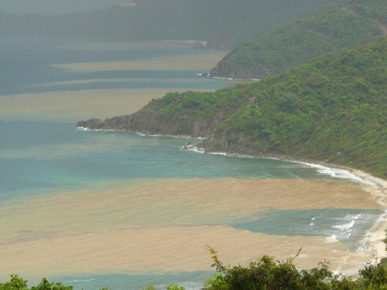
Raising Broad Channel: In this section of Queens, which is built on a marsh jutting into Jamaica Bay, many residents say that despite the repeated flooding, they love their neighborhood and want to stay.

By KIA GREGORY
Published: July 9, 2013 73 Comments


As the sun began to set one recent Sunday, saltwater poured off Jamaica Bay onto West 12th Road, one of the lowest-lying areas in New York City.

Enlarge This Image

Robert Stolarik for The New York Times

Tidal flooding occurs about twice a month in the neighborhood, one of the lowest-lying areas in New York City.

Enlarge This Image

The New York Times

Enlarge This Image

Robert Stolarik for The New York Times

Tidal flooding occurs about twice a month in Broad Channel, Queens, one of the lowest-lying areas in New York City.

Readers’ Comments

Share your thoughts.

Residents bolted out of their front doors to move their cars, which are often damaged by tidal flooding that occurs here about twice a month. Some older residents were all but imprisoned in their homes until as much as three feet of water receded. Children splashed around, oblivious to the looming threat.

“We do not care about budgets; we are taxpaying people,” said John Heaphy, 69, a lifelong resident of the area, Broad Channel, Queens, which is built on a marsh that juts into the bay. “From the lowest politician to the governor’s office, we’ve been begging, please help us.”

Now, the city is doing just that, budgeting $22 million to try to save the neighborhood by installing bulkheads and by raising streets and sidewalks by three feet.

The Broad Channel project offers a preview of the infrastructure outlays that Mayor Michael R. Bloomberg is envisioning as part of a new $20 billion plan to protect the city’s 520 miles of coast over the next decade from rising sea levels.

But the project also raises fundamental questions about whether, in an era of extreme weather, the government should come to the aid of neighborhoods that are trying to fend off inevitably rising waters.

Broad Channel’s vulnerability was exposed in October during Hurricane Sandy, which toppled homes into the bay, some of which still lie in ruins along the beach. Yet the situation here is far worse than in some other neighborhoods damaged in the hurricane because Broad Channel suffers flooding from the tides and heavy rain, not just from storm surges.

Eric A. Goldstein, a senior lawyer at the Natural Resources Defense Council, an environmental advocacy group, said he was sympathetic to Broad Channel and understood why residents have been lobbying hard for aid.

“The problem is, they have picked a spectacularly beautiful but increasingly impractical and dangerous place to live,” Mr. Goldstein said.

“If sea levels rise and storm-level projections are accurate, this community may be surviving on borrowed time,” he said. He added that the city faced hard questions, one being: “How much sense does it make to keep reinvesting taxpayer dollars in a community that is directly in harm’s way?”

Mr. Goldstein said the city should also consider allocating money to those who wanted to relocate.

Other experts pointed out that these projects were not only costly but also difficult to carry out, and based on techniques that might not always work well over time. They must overcome a phalanx of obstacles before being approved, from reviews by government agencies to a lack of consensus among residents.

The one in Broad Channel has already been held up because officials have not yet been able to obtain consent from some residents, which is required because they technically own the sidewalks.

The Bloomberg administration also has expressed concern about the difficulties of protecting this part of the Queens coast.

When Mayor Bloomberg unveiled his $20 billion plan, he vowed that the city would not abandon the waterfront. But the plan notes that major flood protection along Jamaica Bay would be “extremely expensive, and disruptive, and in some cases nearly impossible.”

As a result, the city wants to ask the United States Army Corps of Engineers to develop a storm-surge barrier across the Rockaway Inlet to protect neighborhoods from Sheepshead Bay to Howard Beach, as well as Broad Channel.

As far as the street-raising, Caswell F. Holloway IV, the deputy mayor for operations, acknowledged that such projects were also challenging.

“It is literally a block-by-block issue, especially older neighborhoods, where the neighborhood grew up much faster than the infrastructure to support it,” Mr. Holloway said. “You’re basically going back, in some cases over the course of many years, to do modern drainage. It’s highly disruptive, it’s expensive, because it’s being laid out after the fact.”

Asked whether the Broad Channel project would only forestall the inevitable, he said, “We focused on a solution that was affordable and would alleviate the flooding situation for a while.”

Residents describe Broad Channel as an oasis with glorious water views. About 3,000 people live here, including many police officers and firefighters.

It is a place where residents cling to tide clocks and, some joke, every child gets wading boots for Christmas. Neighbors will honk a car horn in the middle of the night to warn others of an approaching tide, and some have made pencil markings on their homes to show water levels from storms past.

Proposals to safeguard Broad Channel have been debated for years, but gained momentum only after a major storm in 2010.

To address the flooding, Pete Mahon, 65, a retired prison warden, urged fellow residents to pack community meetings where officials were present.

“It was a river running outside,” Mr. Mahon said, referring to 2010.

The project will begin with workers installing bulkheads at 11th, 12th and 13th Roads. Then they will dig up 12th Road, putting in water mains, drains and sewers. The roads will be raised three feet, and paved into a so-called shared-streets design, meaning cars, bicyclists and pedestrians will share the roadway.

All three should be completed in three years, officials said. Then, they estimate, another six streets will be done.

Officials said the street-elevation plan would eliminate 85 percent of tidal flooding on blocks like 12th Road. They said they hoped to get the project started before Mayor Bloomberg leaves office at the end of the year.

Eight months after Hurricane Sandy, life has slowly returned to normal in Broad Channel. Most mom-and-pop stores have reopened. With insurance money in hand, residents are repairing the damage.

But at the heart of the destruction, on West 12th Road, only about half of the families have returned.

“I think you get used to it over time,” said Dashima Cortez, 40, referring to the tidal flooding. “But Sandy made everyone nervous. Some people don’t ever want to come back.”

As the water flowed in that Sunday, her husband, Scott Valentine, sweaty from hanging drywall in a home damaged by Hurricane Sandy, ran to move his car. In five years of living in Broad Channel, they have lost several brakes and a muffler system to flooding.

They moved back in April.

“This is why you stay,” Ms. Cortez said, pointing to the view off their deck.

Later, Mr. Valentine said: “I would love to never have to move, but it’s not going to get any better.”

Nearby, Frank O’Toole, 35, said he had concerns about the $22 million project. What will happen to his garage on a raised street? And what about the oil tanks that people keep in their crawl spaces? But in any case, he said, he supported the plan.

“They say they have it all worked out,” he said.

Mr. O’Toole said he had no plans to leave Broad Channel, though some of his friends called him crazy for it.

“At this point, we’re just desperate to get it done,” he said of the project, standing in water that reached to his shins.

Posted in Uncategorized | Leave a comment

Science from VIMS: Hypoxia Affects Bottom Feeders

from Science Daily: <http://www.sciencedaily.com/releases/2013/07/130708143150.htm>

[As an aside, it seems to me that the low levels of oxygen (e.g.,”below about 4 milligrams per liter“) being measured in the main stem and feeder streams of the South River should cause some re-thinking of the statement that hypoxia is a condition of the “ deep waters of the Bay’s middle reaches,” as highlighted below. ]

‘Dead Zone’ Impacts Chesapeake Bay Fishes

July 8, 2013 — A 10-year study of Chesapeake Bay fishes by researchers at the Virginia Institute of Marine Science provides the first quantitative evidence on a bay-wide scale that low-oxygen “dead zones” are impacting the distribution and abundance of “demersal” fishes — those that live and feed near the Bay bottom.

The affected species — which include Atlantic croaker, white perch, spot, striped bass, and summer flounder — are a key part of the Chesapeake Bay ecosystem and support important commercial and recreational fisheries.
The study, published in a recent issue of Marine Ecology Progress Series, was authored by Andre Buchheister, a Ph.D. student in William & Mary’s School of Marine Science at VIMS, along with VIMS colleagues Chris Bonzek, Jim Gartland, and Dr. Rob Latour.
All four authors are involved in VIMS’ Chesapeake Bay Multi-Species Monitoring and Assessment Program (ChesMMAP), an ongoing effort to track and understand interactions between and among fishes and other marine life within the Bay ecosystem.
Buchheister says “This is the first study to document that chronically low levels of dissolved oxygen in Chesapeake Bay can reduce the number and catch rates of demersal fish species on a large scale.” He notes that other studies have looked at the effects of low oxygen on fishes within the water column and on demersal fishes within individual Bay tributaries.
Low-oxygen conditions — what scientists call “hypoxia” — form when excessive loads of nitrogen from fertilizers, sewage, and other sources feed algal blooms in coastal waters. When these algae die and sink, they provide a rich food source for bacteria, which in the act of decomposition take up dissolved oxygen from nearby waters.
In Chesapeake Bay, low-oxygen conditions are most pronounced in mid-summer, and in the deep waters of the Bay’s middle reaches. “This appears to displace fish biomass toward the northern and southern edges of the bay’s mainstem channel,” says Buchheister.
“The drastic decline we saw in species richness, species diversity, and catch rate under low-oxygen conditions is consistent with work from other systems,” he adds. “It suggests that demersal fishes begin to avoid an area when levels of dissolved oxygen drop below about 4 milligrams per liter, as they start to suffer physiological stress.”
The fishes’ response at this value is interesting, says Buchheister, “because it occurs at levels greater than the 2 milligrams per liter that scientists formally use to define hypoxia.” Normal coastal waters contain from 7-8 milligrams of oxygen per liter.
Previous research suggests that oxygen-poor waters can stress fish directly, through increased respiration and elevated metabolism, and also by affecting their prey.
“Low levels of dissolved oxygen stress or kill the bottom-dwelling invertebrates that demersal fishes rely on for food,” says Buchheister. “Prolonged exposure of these invertebrates to hypoxic conditions in the mid-Bay represents a substantial reduction in the habitat available for foraging by demersal fishes baywide, and could reduce the quality of foraging habitat even after bottom waters become re-oxygenated.”
The authors caution, however, that the limits on fish abundance and distribution brought on by low-oxygen conditions are to some degree balanced by the positive effects that nutrients have on production of mid-water and surface-dwelling fishes elsewhere in the Bay. The nutrient-rich waters that encourage dead-zone formation also fuel algal growth, thus turbocharging the base of a food web that ultimately supports fish and other predators.
ChesMMAP
The team’s findings are based on an exhaustive study of the distribution and abundance of late juvenile and adult fishes caught and released in trawl nets during 48 sampling trips between 2002 and 2011, the largest quantitative assessment of the bay-wide demersal fish community ever conducted. The sampling took place at 3,640 ChesMMAP stations throughout the mainstem of Chesapeake Bay.
ChesMMAP, currently funded by Wallop-Breaux funds from the Virginia Marine Resources Commission, was established in 2002 as part of the growing international recognition that a single-species approach to fisheries management does not fully account for the complex interactions within marine ecosystems.
Latour, head of the Multispecies Research Group at VIMS, says “The traditional approach to fisheries management looks at a single species as if it were independent, unaffected by other processes and having no effect on other species. In ChesMMAP and our other multispecies research programs we analyze the interactions between species and their environment, including studies of predator-prey dynamics, seasonal changes in distribution, and water-quality parameters such as temperature, salinity, and DO [dissolved oxygen].”
Salinity
Indeed, the team’s research shows that salinity is the most important factor affecting the distribution of Bay fishes, whether they live near the bottom or towards the surface.
“Salinity was the major environmental gradient structuring community composition, biodiversity, and catch rates in our 10-year dataset,” says Buchheister. “The saltier waters of the lower Bay and the fresher waters of the upper Bay generally have a more diverse and dynamic fish fauna than the middle Bay, whose brackish waters place physiological demands on many aquatic organisms.”
Future value
The value of the ChesMMAP dataset extends beyond the current study. “Our work provides a 10-year frame of reference that can be used to evaluate future large-scale changes in the composition, distribution, and abundance of the Bay’s demersal fish community,” says Latour. “Continued monitoring will be critical for detecting how the Bay ecosystem responds to continued stresses from fishing, development, and climate change. It’s an essential component to a successful management strategy for the marine resources of Chesapeake Bay and the coastal Atlantic.”

Share this story on Facebook, Twitter, and Google:

Other social bookmarking and sharing tools:
Share on stumbleuponShare on linkedinShare on pinterest_shareShare on bloggerShare on diggShare on deliciousShare on newsvine|7

Posted in Uncategorized | Leave a comment

Comment Not Posted: Chrystal Spring Farms Public Meeting 26 June 2013

I restrained myself from commenting on Elvia Thompson’s Facebook post showing the very big audience attending the meeting on Chrystal Springs Farm. I post it here because it won’t be read —

It is wonderful to see such interest; it is sad to know that this is at least FIVE YEARS TOO LATE — the battle was lost in most LEGAL aspects when Chrystal Spring Farms was annexed into Annapolis, as some environmental leaders warned at the time.

So much wasted effort. To understand what CAN be done to mitigate development impacts in a significant way, people should study the Anne Arundel County Growth Tiers, June 2013 at
http://www.aacounty.org/PlanZone/LongRange/GrowthTiers.cfm#.Ucub12TF1Pw

Posted in Uncategorized | Leave a comment

“Facing Tough Times, Barbuda Continues Sand Mining Despite Warnings”

[Thanks to Bill Rainey for passing this along, and thanks to Desmond Brown of IPS for several excellent articles about the local/Carribean impacts of climate change.. . . .

The folks in Barbuda (and Antigua) need to understand that it’s not about a “warning” — it’s a virtual CERTAINTY that continued sand mining in the face of the added stresses from global climate change (sea level rise, increased frequency of severe storms, increasing variability in wind patterns) will make Barbuda UNINHABITABLE within the lifetimes of people alive today — explain THAT to your grandchildren.
There is a precedent: the island of Nauru in Micronesia — here’s a short excerpt about Nauru from Wikipedia that fails to capture the extreme social pressures among the 9,000 Nauru that have arisen from the country’s bankruptcy since the phosphate rock was all mined:

Nauru became self-governing in January 1966, and following a two-year constitutional convention it became independent in 1968 under founding president Hammer DeRoburt.[27] In 1967, the people of Nauru purchased the assets of the British Phosphate Commissioners, and in June 1970 control passed to the locally owned Nauru Phosphate Corporation.[15]Income from the mines gave Nauruans one of the highest standards of living in the Pacific.[28] In 1989, Nauru took legal action against Australia in the International Court of Justiceover Australia’s administration of the island, in particular Australia’s failure to remedy the environmental damage caused by phosphate mining. Certain Phosphate Lands: Nauru v. Australia led to an out-of-court settlement to rehabilitate the mined-out areas of Nauru.[26][29]

Read more about Nauru on Wikipedia or read the book:

  • <Gowdy, John M; McDaniel, Carl N (2000). Paradise for Sale: A Parable of. University of California Press. ISBN 978-0-520-22229-8.>

Sell the beaches today, and you will have nothing to mine to build the breakwaters and causeways that you will need when the water is a meter deeper. . . .   bp]

Facing Tough Times, Barbuda Continues Sand Mining Despite Warnings

By Desmond Brownl

CODRINTON, Barbuda, Jun 22 2013 (IPS) – Arthur Nibbs was known for his staunch opposition to sand mining in his homeland of Barbuda, a Caribbean island with dazzling white sand beaches that comprise most of its deserted coastline.

But Nibbs, the chairman of the Barbuda Council, has had a change of heart because of the economic hardships residents face here, he said.

He is dismissing warnings by environmentalists that sand mining has exceeded safe limits and that its continuation is placing Barbuda, the tiny island in the Antigua and Barbuda union, at ever-greater risk from storms and sea level rise.

“Reality has set in,” Nibbs told IPS, noting that the council is currently in deep financial trouble. “Our finances usually come from the central government,” he explained, but the government itself is in “a precarious situation”.

“Sand mining…is the only revenue source that we have.”

— Arthur Nibbs

 “We are forced to continue…sand mining because that’s the only revenue source that we have, and we need to meet our obligations on a daily basis,” he said.

“Would you prefer to appear to be protecting the environment and then have your people going hungry with no food on their table and people can’t pay their bills?” he asked.

Barbuda, one of the lowest lying islands in the Caribbean, has been labelled as one of those most vulnerable to the effects of climate change, with local scientists complaining that the 62-square-mile island, made up of wetlands, is becoming one of the most vulnerable spots on earth with respect to the consequences of climate change.

A year ago, Nibbs criticised then-council chairman Kelvin Punter’s decision to resume sand mining as “foolishness”.

He is fully aware that he now appears to be flip-flopping on the subject.

“I’m sure the whole of Antigua and Barbuda is accustomed to hearing me talk about sand mining and the damage that it has done to the environment,” he agreed, noting that he had “every intention” of trying to move away from the practise.

“But that just was not possible,” he argued. “You have to take care of the people right now.”

Nibbs is not against a long-term development strategy for the island, but he says that “sitting down making up a development plan will not pay your bills” and that developing such a plan and finding ways to meet people’s daily needs must occur simultaneously.

He is optimistic that under his leadership Barbuda will pull itself out of this situation, and he pointed to planned development in the form of hotel resorts in about 18 months to two years.

“We do need something that can give us money quickly,” Nibbs said. “Sand mining is the only thing.”

Digging a deeper hole

But marine biologist John Mussington is worried Barbuda is digging its way off the planet.

“Where do they intend to get the sand from? Do they intend to dig such a hole that they sink Barbuda?” he questioned.

Sand mining here began in 1976 and by the mid-1990s, major environmental reports were warning that the extent of mining was causing irreparable damage.

“The fact of the matter is [that]…in 2006, the technicians from the environment division came to Barbuda and they were so shocked and appalled at the damage that was being done that they called for an immediate halt to sand mining,” Mussington told IPS.

The technicians said that in the long run, mining would expose Barbuda to many consequences of climate change, and they recommend that the island cease mining.

Following a 2006 cabinet decision, Mussington said, the technicians conducted surveys, and 103 acres were allocated for sand mining. But within a year and a half, those 103 acres were exhausted.

“Sand was supposed to be taken out following certain strict guidelines but the guidelines were never followed. The acreage given was exhausted.”

Calling large-scale sand mining a “destructive and irrational practice”, Eli Fuller, a marine environmentalist, offered alternatives means of income for Barbudans, including light tackle and deep-sea sport fishing.

Fuller added that cruise tourism could also be a source of income. “Many of the ships visiting some of the Caribbean’s most celebrated destinations anchor offshore and tender their guests to little docks on the mainland,” he said.

“Without any significant investment, this could happen in Barbuda almost immediately. One or two small ships a week could provide significantly more employment than the entire mining industry does in Barbuda,” Fuller added.

In the neighbouring island of Nevis, authorities have adopted a zero tolerance approach to sand mining.

Premier Vance Amory told IPS that the wellbeing of the island’s pristine environment is of utmost importance to his administration.

“The erosion of our coastline has cost us a loss of significant historical proportions,” he said. Illegal sand mining “reduces the beauty of the beaches”, which are critical for tourism, he said. It also leads to erosion and creates a situation that makes breaking the law more likely in other areas.

“We are intent as an administration on restoring respect for our environment,” Amory added.

The minister of agriculture in the Nevis Island administration, Alexis Jeffers, said sand mining is hurting marine life on the island.

“The sand is there for a reason,” he told IPS. “If we remove it, we remove a particular element of the ecosystem that would create problems for the future generations to come.”

Related IPS Articles

Posted in Beaches, Climate Change, Governance, Sand mining | Leave a comment

Most Beaches in the South River Watershed Contaminated in 19 June Testing by STORMWATER RUNOFF

This is what happens when stormwater runoff is left untreated, and runs straight to the Bay (or nearest river going to the Bay!)

Posted by Captain Diana Muller, South RiverKeeper <www.southriverfederation.net> on Friday, June 21st, and reposted in the report below on the WaterKeeper Swim Guide.

Posted in Uncategorized | Leave a comment

So Here’s Another Path to Greater Environmental Sustainability . . . .

The 21st century will require major institutional change to create great sustainability in the face of greater stressors from 9 to 10 billion earthlings. This new book by Amy Larkin , to be released June 25th, may be a guide to the key financial issues to help get costs and prices more in line. . .

From the Amazon blurb (note there’s a Kindle version if you want to save a tree and a few bucks) —

Environmental Debt: The Hidden Costs of a Changing Global Economy [Hardcover]

Amy Larkin (Author)

Book Description

Release date: June 25, 2013

An award-winning environmental activist and social entrepreneur exposes the link between our financial and environmental crises

For decades, politicians and business leaders alike told the American public that today’s challenge was growing the economy, and that environmental protection could be left to future generations. Now in the wake of billions of dollars in costs associated with coastal devastation from Hurricane Sandy, rampant wildfires across the West, and groundwater contamination from reckless drilling, it’s becoming increasingly clear that yesterday’s carefree attitude about the environment has morphed into a fiscal crisis of epic proportions.

Amy Larkin has been at the forefront of the fight for the environment for years, and in Environmental Debt she argues that the costs of global warming, extreme weather, pollution and other forms of “environmental debt” are wreaking havoc on the economy. Synthesizing complex ideas, she pulls back the curtain on some of the biggest cultural touchstones of the environmental debate, revealing how, for instance, despite coal’s relative fame as a “cheap” energy source, ordinary Americans pay $350 billion a year for coal’s damage in business related expenses, polluted watersheds, and in healthcare costs. And the problem stretches far beyond our borders: deforestation from twenty years ago in Thailand caused catastrophic flooding in 2011, and cost Toyota 3.4 percent of its annual production while causing tens of thousands of workers to lose jobs in three different countries.

To combat these trends, Larkin proposes a new framework for 21st century commerce, based on three principles: 1) Pollution can no longer be free; 2) All business decision making and accounting must incorporate the long view; and 3) Government must play a vital role in catalyzing clean technology and growth while preventing environmental destruction. As companies and nations struggle to strategize in the face of global financial debt, many businesses have begun to recognize the causal relationship between a degraded environment and a degraded bottom line. Profiling the multinational corporations that are transforming their operations with downright radical initiatives, Larkin presents smart policy choices that would actually unleash these business solutions to many global financial and environmental problems.

Provocative and hard-hitting, Environmental Debt sweeps aside the false choices of today’s environmental debate, and shows how to revitalize the economy through nature’s bounty.

Posted in Uncategorized | Leave a comment

Thanks to Both Congress and the Executive, the Sequester Now Reigns

from the Washington Post:

The Washington Post
As red ink recedes, pressure fades for budget deal
After four years of trillion-dollar deficits, the red ink is receding rapidly in Washington, easing pressure on policymakers but shattering hopes for a summertime budget deal.Federal tax revenue is up and spending is down thanks to an improving economy, tax increases that took effect in January and the automatic budget cuts known as the sequester.

The net effect will be that the system will stabilize with all of the idiocy of the across-the-board, meat-ax approach that the sequester creates (except, of course,  for the air traffic controllers and some meat inspectors).

Increasingly, governance in the USA looks like the design of the worst possible compromise.

Posted in Governance | Tagged | Leave a comment

Wonder what this looks like for the insular Caribbean

from the Economist:

Focus

Development finance in Africa

May 7th 2013, 14:43 by Economist.com

NOT long ago, the lion’s share of official aid to poor countries was provided by rich Western governments that carefully report what they give and to whom. But recent years has seen arapid increase in aid from non-Western sources that do not always prioritise transparency. A new working paper from the Centre for Global Development (CGD) attempts to gauge aid flows to Africa from China, one of the more opaque givers. In the absence of comprehensive official figures, the CGD compiled a database using open-source media reports. It says that China committed $75 billion in aid between 2000 and 2011, almost as much as America ($90 billion) and nearly a fifth of the total flows reported by Western governments. Two of the largest identifiable categories, by value, were transport and energy, which could fuel suspicions that China’s provision of aid is aimed at securing natural resources. But the counter-argument holds that Chinese aid, which focuses on overlooked areas like infrastructure, rather than education or health, is actually complementary to the West’s.

Posted in Uncategorized | Leave a comment